





Wind Maps & Forecast Charts
Live interactive wind map • Animated global wind visualisation • English Channel & British Isles forecast charts
Live Interactive Wind Map
Live animated wind map centred on the Solent and Southampton Water. Use the buttons to switch overlays:
Windy.com • ECMWF model • Drag to pan • Scroll to zoom • Click for point forecast
Wind Forecast Charts
GFS model wind, gust and wave height charts from PassageWeather.com. Use the controls below to choose your area, variable and forecast period:
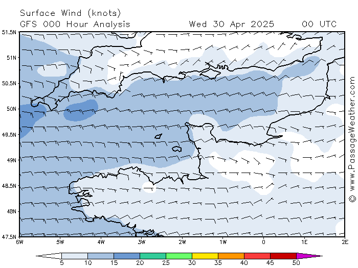
Source: PassageWeather.com • GFS model • Updated every 6 hours
Animated Global Wind Visualisation
Real-time animated global wind field from earth.nullschool.net. The map is centred on the British Isles. Drag to rotate, scroll to zoom. Wind speed is colour-coded from blue (calm) through green and yellow to red/white (storm force). Particle trails follow the actual wind direction.
Source: earth.nullschool.net • Drag to rotate the globe • Scroll to zoom • Click any point to read wind speed
About These Sources
|
Windy.com uses ECMWF forecast data to produce its interactive animated maps. The ECMWF model is widely regarded as the most accurate global weather model and is the same data used by professional meteorologists. The overlay buttons let you switch between wind, gusts, pressure and wave height. PassageWeather provides GFS-based wind and wave forecasts tailored for sailors and mariners. Forecast charts are available for the English Channel (the most locally relevant view for Southampton) and the wider British Isles region. Each chart is updated every 6 hours as new GFS model runs become available. |
Earth.nullschool.net produces a stunning real-time animated visualisation of the global wind field at the surface and at various altitudes. Unlike a static forecast chart, the particle animation gives an intuitive sense of wind direction and relative strength across the whole hemisphere at a glance. Remember that forecast accuracy decreases with time. The Analysis (0h) chart shows the current modelled wind field. Forecasts to +48 hours are generally reliable; beyond that they should be treated as a guide to the broad pattern rather than precise speeds. Always check an up-to-date marine forecast for safety-critical decisions. |
Interactive map: Windy.com • Forecast charts: PassageWeather.com • Global animation: earth.nullschool.net